PAGASA: “SURIGAE” Slightly Intensifies While Almost Stationary
PAGASA has released another Tropical Cyclone Advisory providing updates on Tropical Storm SURIGAE.
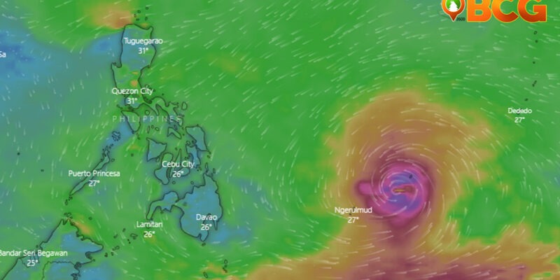
According to the weather bureau, TS Surigae is still located outside of the Philippine Area of Responsibility (PAR), 1.205 km East of Mindanao. It has maximum sustained winds of 75 km/h, with a gustiness of 90 km/h, staying at an almost stationary position.
Weather Forecast
“SURIGAE” intensified into a tropical storm at 2:00 AM today. It may intensify into a severe tropical storm in the next 24 hours. It is forecast to continuously intensify throughout the forecast period and may reach typhoon category by Friday, April 16, 2021. When SURIGAE enters PAR, it will be assigned the domestic name “BISING.”
While it was stated in the former Tropical Cyclone Advisory the TS remains less likely to directly affect the country over the next three days, residents, as well as disaster risk reduction management offices, in Southern Luzon and Visayas are advised to continuously monitor updates for this cyclone due to the uncertainty in the track forecast of this storm.
Related: What to do before, during, and after a Typhoon
PAGASA says a westward shift in the current track may result in potentially significant impacts in the said areas over the weekend until Monday.
Tropical Cyclone Forecast Positions
| Date | Forecast Position | Intensities |
| Tomorrow morning 15 April 2021 |
1,165 km East of Mindanao (Hinatuan, Surigao del Sur) (Outside PAR) (08.7°N, 136.9°E) | Severe Tropical Storm |
| Friday morning 16 April 2021 |
1,065 km East of Mindanao (Surigao City, Surigao del Norte) (Outside PAR) (09.4°N, 135.2°E) | Typhoon |
| Saturday morning 17 April 2021 |
710 km East of Guiuan, Eastern Samar (10.8°N, 132.2°E) | Typhoon |
| Sunday morning 18 April 2021 |
590 km East of Juban, Sorsogon (13.1°N, 129.4°E) | Typhoon |
| Monday morning 19 April 2021 |
725 km East of Infanta, Quezon (14.8°N, 128.4°E) | Typhoon |
SOURCE: PAGASA


