
Strong quake jolts Cebu and Leyte; PHIVOLCS logs M6.7 off Bogo City
UPDATE June 24, 2026 8:24 PM:
(adsbygoogle = window.adsbygoogle || []).push({});
Updates
- PHIVOLCS Upgraded its initial reading from 6.7 to 6.9 Magnitude same with the USGS Reading
- More aftershocks recorded ranging from magnitude 2.2 to 4.4
- Phivolcs issued Tsunami Information no.1 for MINOR SEA-LEVEL DISTURBANCE
- As of writing 3 aftershocks were recorded with magnitudes 3.8, 2.4 and 3.2 respectively
Time and date: 9:59 p.m. PHT, Tuesday, September 30, 2025.
Preliminary magnitude:6.7, now upgraded to Magnitude 6.9.
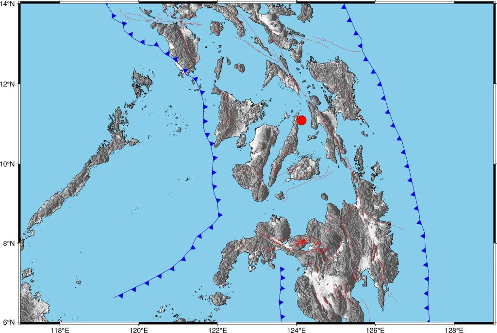
Epicentral area:offshore near Bogo City, Cebu, felt widely across Cebu and Leyte.
Reported shaking: Instrumental intensities up to VI in Cebu City and Villaba, Leyte; lighter shaking reported in parts of Northern Samar.
A powerful earthquake struck the Visayas on Tuesday night, 30 September 2025, with the Philippine Institute of Volcanology and Seismology (PHIVOLCS) reporting a preliminary magnitude 6.7 from an offshore epicenter east of Bogo City, Cebu at 9:59 p.m. (PHT). Tremors were felt across Cebu and neighboring provinces including parts of Leyte, according to initial media reports citing PHIVOLCS’ bulletin.
What we know so far
Early intensity readings and field accounts indicate strong shaking in sections of Cebu and northern/western Leyte, with updates expected as PHIVOLCS refines its instrumental and felt intensity maps. Local disaster risk reduction offices have urged residents to brace for aftershocks and to inspect structures for damage before re-entry once shaking has stopped. PHIVOLCS’ earthquake information portal will carry successive parameter refinements and intensity distributions as they are processed.
International agencies also detected the event. The U.S. Geological Survey (USGS) registered a very strong earthquake at 13:59 UTC, the same local time as PHIVOLCS (9:59 p.m. PHT), with a preliminary magnitude of 6.9 (Mw) located offshore in the Cebu–Camotes area near Ponson Island. Magnitude and location values from USGS and PHIVOLCS may differ slightly at this stage due to the use of different magnitude scales, processing pipelines, and real-time station availability.
As of press time, there has been no official tsunami warning specific to this event posted on PHIVOLCS’ public channels, but monitoring continues. Authorities advise coastal communities to remain attentive to official advisories and to avoid spreading unverified claims about sea level changes. For authoritative updates on potential sea hazards and aftershocks, follow PHIVOLCS and local Disaster Risk Reduction and Management Offices (DRRMOs).
(adsbygoogle = window.adsbygoogle || []).push({});
For more information, see our complete guide on 800 Examinees Successfully Passed the 2020 Physician Licensure Examination.


