
PAGASA implements Modified Tropical Cyclone Warning Signal System
UPDATE May 13, 2026 11:30 AM:
(adsbygoogle = window.adsbygoogle || []).push({});
Effective March 23, 2022, the Philippine Atmospheric, Geophysical and Astronomical Services Administration (PAGASA), have implemented a Modified Tropical Cyclone Warning Signal System. The modifications in the tropical cyclone warning signal system were implemented based on gathered data, research, and feedback from stakeholders.
Changes in the PAGASA Tropical Cyclone Warning System
There are several changes implemented in the tropical cyclone warning system and these are:
- Revised Definition of the Super Typhoon Category – after the devastation caused by typhoon Yolanda in 2013 there were several requests to include a Super Typhoon category, this request was carried out in 2015. At that time, Super Typhoons were classified as those that carry a maximum strong wind of 220kph near the center. This classification has now been modified where as of today, a typhoon will be classified as a super typhoon when it carries a maximum strong wind of at least 185kph near the center. This means also that a typhoon will now be classified when it has a maximum wind of 118 km/h to 184 km/h from the previous 118 km/h to 220 km/h.
- Modified Tropical Cyclone Wind Signal System (TCWS) – due to the change in the definition of the super typhoon category PAGASA also deemed it necessary to modify the TCWS. The TCWS will now be following the international standard Beaufort scale which is used by the World Meteorological Association. Based on these standards here are the modified TCWS:
Wind Signal Number 1 Wind Signal Number 2 Wind Signal Number 3 Wind Signal Number 4 Wind Signal Number 5 Strong winds will be felt within 36 hours Gale force winds will be felt within 24 hours Storm force winds will be felt within 18 hours Typhoon force winds will be felt within 12 hours Typhoon force winds will be felt within 12 hours Wind speed at 39 - 61 km/h Wind speed at 62 - 88 km/h Wind speed at 89-117 km/h Wind speed at 118-184 km/h Wind speed at 185 km/h or higher - Updated Tropical Cyclone Forecast Chart – A new Tropical cyclone forecast chart is now being implemented. Included in the changes is the inclusion of 12hr, 36hr, and 60hr forecast positions. In addition, tropicals cyclone wind areas will also be added which can be identified with orange and maroon colors. Areas covered in orange are areas currently experiencing wind signals equivalent to Signal number 1 or 2, while areas inside maroon color are areas experiencing wind signals equivalent to wind signal number 3 or higher.
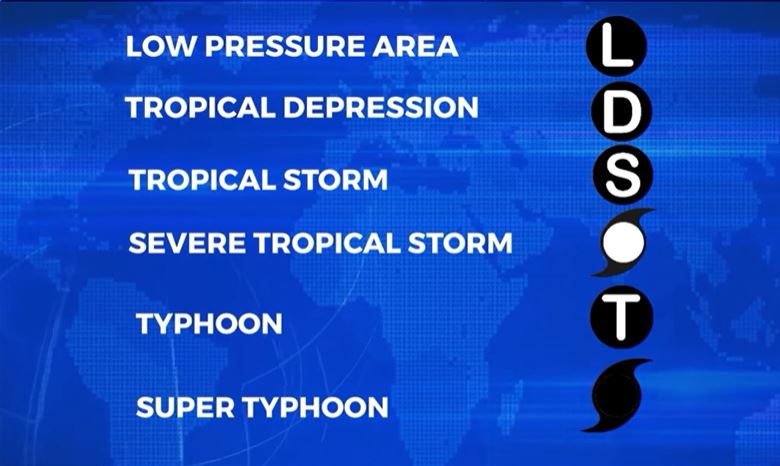
- New Forecast Chart Icons – to avoid confusion on the category of the storm, the following icons will be used to identify each storm category.
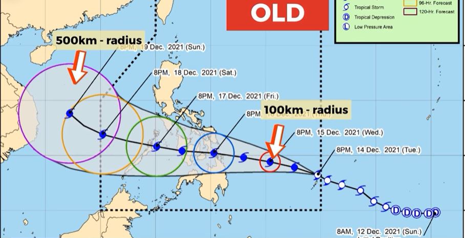
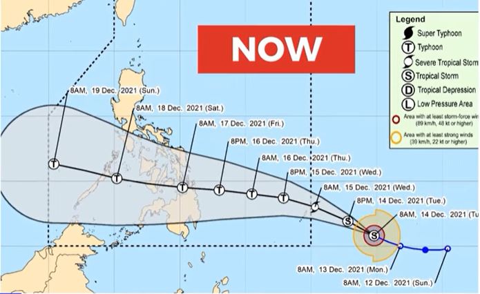
- Change in the Probability Cone format – the probability cone format will now be dependent on the data gathered on the track area performance by PAGASA. Compared to the previous standard 100 km radius in 24-hour forecast to 500km radius in 120 hr forecast.
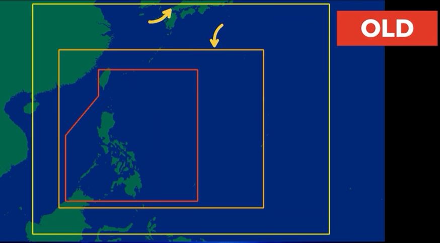
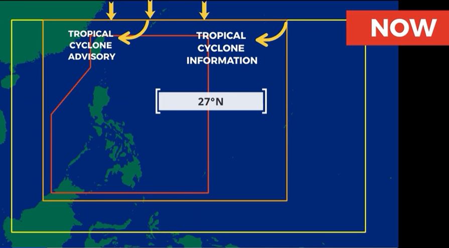
- Revised Tropical Cyclone Forecast Areas – the northern boundary of the extended tropical cyclone forecast areas which includes the tropical cyclone advisory and the tropical cyclone information is now at 27 degrees North.
(adsbygoogle = window.adsbygoogle || []).push({});
(adsbygoogle = window.adsbygoogle || []).push({});
(adsbygoogle = window.adsbygoogle || []).push({});
For more information, see our complete guide on 10 Things You Can Do to Keep Your Cool This Summer.
For more information, see our complete guide on Typhoon Quinta.


