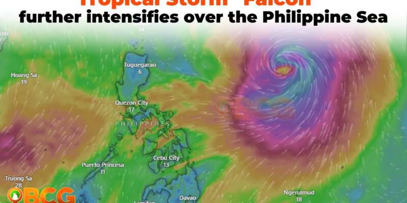
Falcon further intensifies over the Philippine Sea
Tropical Storm FALCON continues to strengthen as it traverses the Philippine Sea. At 10:00 AM, its center was located approximately 1,210 km East of Central Luzon or 1,235 km East of Northern Luzon (17.5°N, 133.4°E). The storm now exhibits maximum sustained winds of 85 km/h near the center, with gusts reaching up to 105 km/h. Additionally, its central pressure has dropped to 990 hPa. Currently, FALCON is moving in a north-northwestward direction at a speed of 15 km/h.
Hazards affecting land areas
Heavy Rainfall Outlook
The Southwest Monsoon, bolstered by Tropical Storm FALCON, is expected to bring intermittent monsoon rains over the western parts of Luzon and Visayas in the next three days.
Severe Winds
As of the current forecast scenario, the likelihood of raising any Wind Signal due to FALCON over any locality in the country remains low. However, the enhanced Southwest Monsoon will bring gusty conditions over specific areas, especially in coastal and upland/mountainous regions exposed to winds, on the following days:
- Today and tomorrow: Zambales, Bataan, Pampanga, Bulacan, Metro Manila, Occidental Mindoro, Palawan, Romblon, Northern Samar, and most of CALABARZON, Bicol Region, and Western Visayas.
- Monday: Ilocos Norte, Pangasinan, Zambales, Bataan, Pampanga, Bulacan, Metro Manila, Occidental Mindoro, Palawan, Romblon, Northern Samar, and most of CALABARZON, Bicol Region, and Western Visayas.
- Tuesday: Ilocos Region, Abra, Benguet, Zambales, Bataan, Bulacan, Metro Manila, Bicol Region, and most of CALABARZON, MIMAROPA, and Western Visayas.
Track and Intensity Outlook
- As FALCON remains over the Philippine Sea, it is projected to continue moving north-northwestward until tomorrow, after which it will turn northwestward on Monday. Based on the current track forecast, the tropical storm may exit the Philippine Area of Responsibility (PAR) on Monday afternoon or evening. Beyond the PAR region, FALCON will then turn west-northwestward, passing close to the Okinawa Islands in the Ryukyu Archipelago between Monday late evening and Tuesday morning. Subsequently, it is expected to move over the East China Sea before making landfall along the east coast of China on Wednesday afternoon or evening.
- Over the next 3 days, FALCON is forecasted to continuously intensify. It is projected to become a typhoon between tomorrow late evening or on Monday morning and reach its peak intensity on Tuesday.
Residents in areas identified as highly or very highly susceptible to these hazards are urged to follow evacuation and other instructions from local officials. The next tropical cyclone bulletin will be issued at 5:00 AM tomorrow.


