
The Cordilleras Didn’t “Exist” in this 1734 Philippine Map; Here’s Why
UPDATE May 13, 2026 11:36 AM:
(adsbygoogle = window.adsbygoogle || []).push({});
The Velarde map, known as the “Mother of all Philippine Maps,” reveals a great deal about the Philippines in the 18th century, as well as the perspectives of its Spanish creators. One aspect of the map that is particularly intriguing is the representation, or rather the lack of representation, of the Cordillera region, where present-day Baguio City, Benguet, and the Mountain Province are located.
(function(){var s=document.querySelector(‘script[data-playerPro=”current”]’);s.removeAttribute(“data-playerPro”);(playerPro=window.playerPro||[]).push({id:”z2I717k6zq5b”,after:s,appParams:{“C_NETWORK_CODE”:”23018154962″, “C_WEBSITE”:”baguiocityguide.com”}});})();
The Velarde map, made in 1734 by Jesuit cartographer Pedro Murillo Velarde, engraver Nicolás de la Cruz Bagay, and artist Francisco Suárez, is an invaluable artifact that illustrates the Philippines during Spanish colonial rule. This map, known as the “Mother of all Philippine Maps,” with its meticulous illustrations of various ethnic groups, cities, islands, and even endemic plants and animals, provides a fascinating snapshot of the archipelago’s diverse cultures and rich biodiversity in the 18th century.
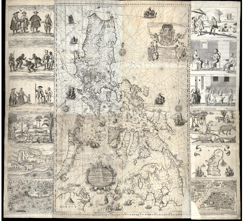
A Hydrographical and Chorographical Chart of the Philippine Islands, Retrieved from the Library of Congress, World Digital Library
(adsbygoogle = window.adsbygoogle || []).push({});
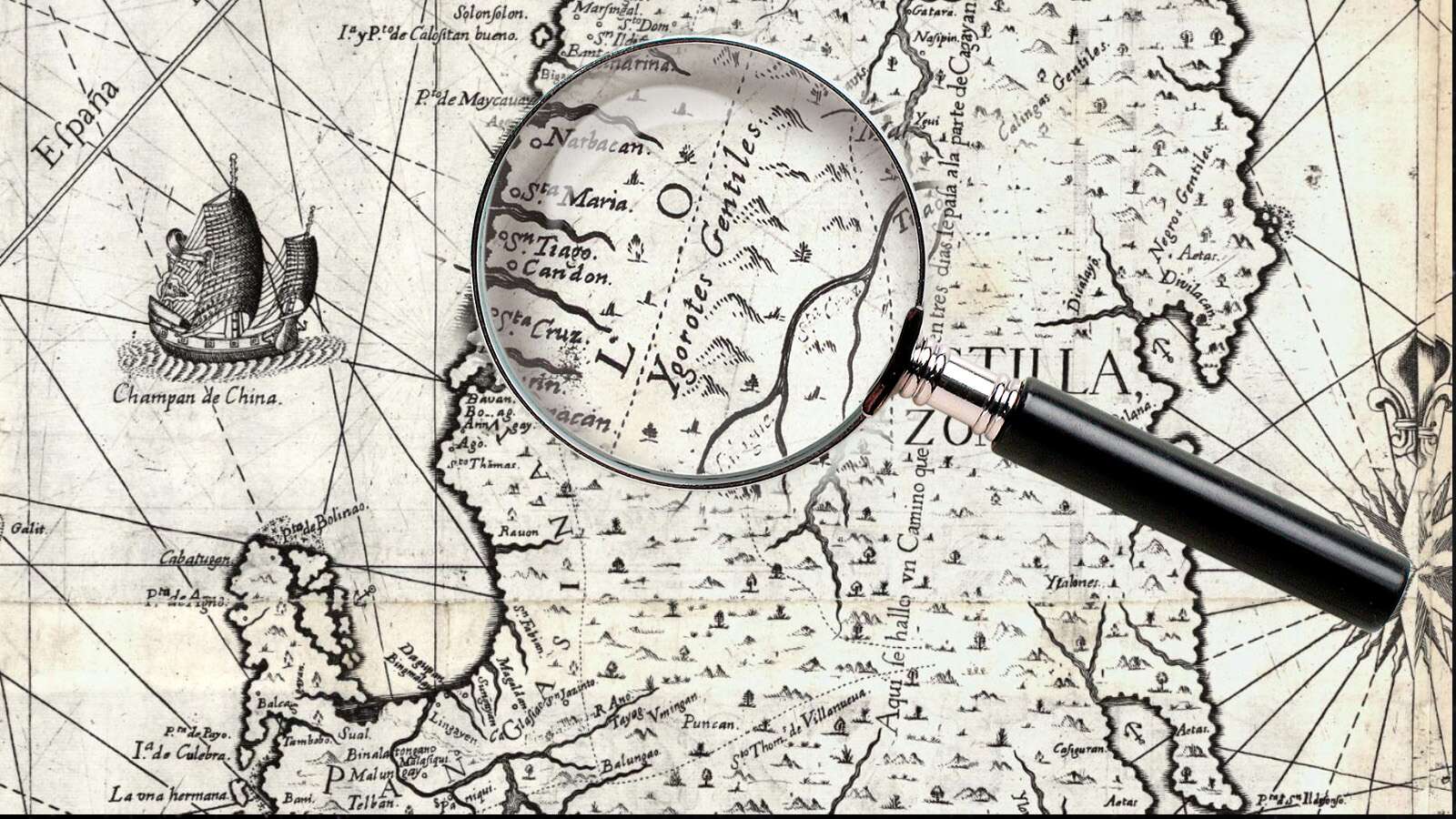
However, when it comes to the Cordillera region, the map noticeably lacks detail. Instead of marking specific tribes or geographic features, the area is labeled broadly as “Ygorotes Gentiles.”
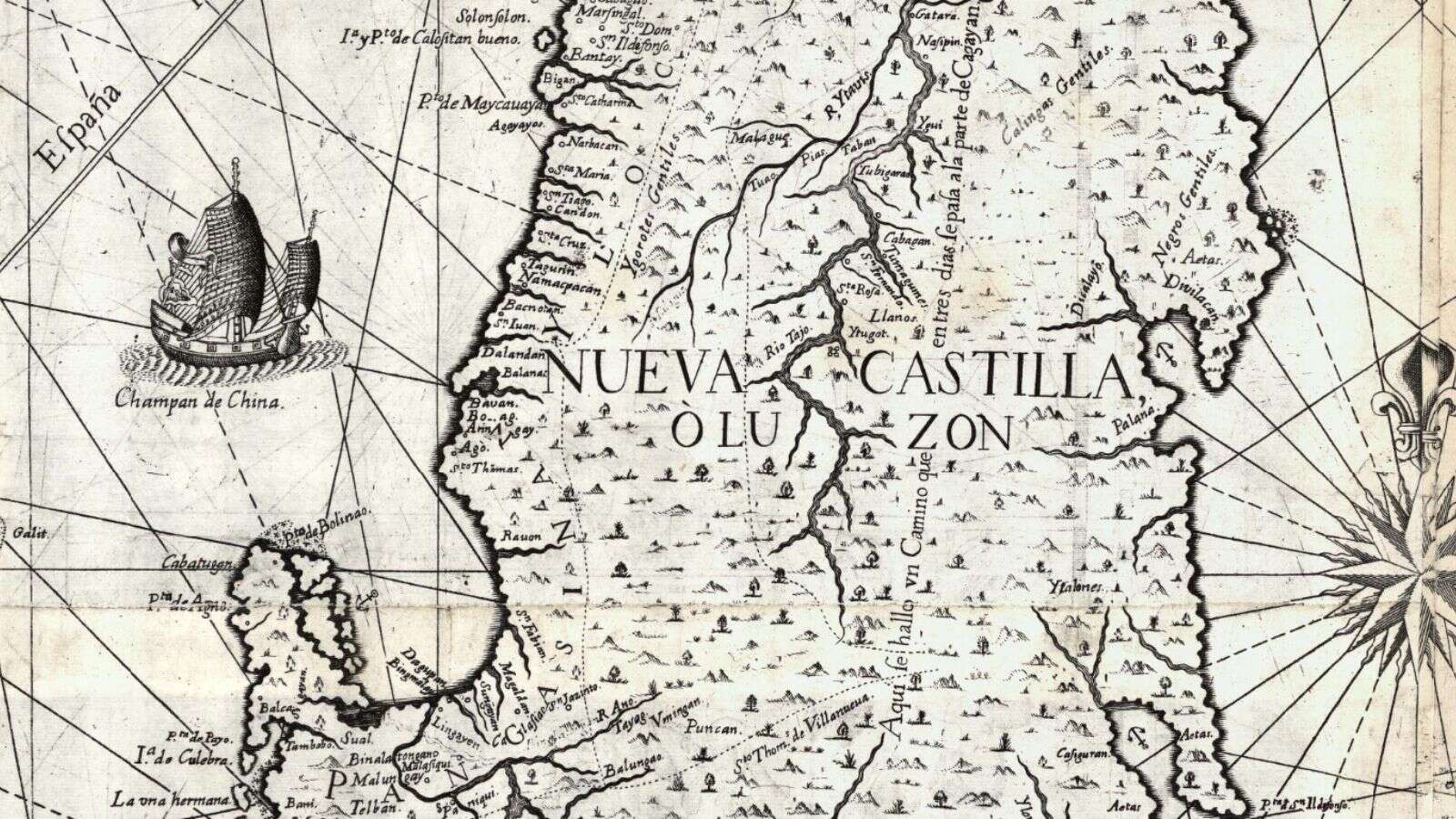
A closeup from A Hydrographical and Chorographical Chart of the Philippine Islands, Retrieved from the Library of Congress, World Digital Library
“Ygorotes” is an old term referring to the Igorot people, and “Gentiles” often was used to denote people who weren’t Christian. This lack of specificity contrasts starkly with the map’s detailed depictions of other regions and their inhabitants.
(adsbygoogle = window.adsbygoogle || []).push({});
So, why were the Cordilleras relatively ‘invisible’ in the Velarde map? The answer lies in the historical relationship between the Spanish colonizers and the Igorot people. The Cordillera region, home to various Igorot tribes, was known for its rugged terrain and fiercely independent inhabitants. The Igorots resisted Spanish conquest, maintaining their autonomy throughout Spain’s 333 years of colonial rule in the Philippines. This resistance culminated in the Igorot Revolt in the 1600s, where the Igorots successfully repelled Spanish forces.
The limited representation of the Cordilleras on the Velarde map reflects the Spanish colonizers’ limited knowledge and control of the area. The Igorots’ successful resistance to Spanish colonization meant that the region remained largely unexplored and unconquered by the Spanish. Therefore, the mapmakers could not provide detailed depictions of the region or its inhabitants.
(adsbygoogle = window.adsbygoogle || []).push({});
The Velarde map, while being a remarkable artifact of Philippine history, also serves as a reminder of the Igorots’ resilience and their successful resistance against Spanish colonization. Today, the Cordilleras are recognized for their rich cultural heritage, distinct traditions, and the historical significance of their struggle for self-determination. The story of the ‘invisible’ Cordilleras in the Velarde map is a testament to the enduring spirit of the Igorot people and their crucial role in Philippine history.
In the modern era, the Velarde map has taken on new significance. It has been used to assert the Philippines’ territorial rights in the West Philippine Sea and has been donated to the government for public display by businessman Mel Velarde. Replicas of the map have also been donated to various institutions as part of a campaign to raise awareness about its significance to Philippine cultural heritage.
While the Velarde map may not have fully ‘seen’ the Cordilleras back in 1734, its importance in contemporary Philippine culture and the recognition it brings to the country’s diverse ethnic groups, including the Igorots, ensures that these ‘invisible’ regions are invisible no more.
(adsbygoogle = window.adsbygoogle || []).push({});
For more information, see our complete guide on Municipality of Itogon: General Community Quarantine (GCQ) Guidelines.


